
Luttrellstown Castle
& Golf Course

PROJECT OVERVIEW
Luttrellstown Castle is a historic castle estate set within a mature landscaped demesne, with a complex mix of stone-built architectural features, courtyards, roof forms, garden walls, access roads and surrounding landscape. As a heritage structure, the existing building fabric, external elevations, site levels and wider context required careful digital recording so that any future design work could be developed with a clear understanding of the existing conditions.
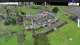
For this project, the architects required an accurate photogrammetric model and pointcloud of the castle and surrounding site. The purpose of the survey was to provide a reliable digital base for understanding the site levels, building context, landscape setting and relationship between the existing castle structure and the proposed design. The 3D OBJ model was also intended to be used as a visual backdrop for CGI production, allowing the proposed design to be shown within its real heritage setting.
Survey Methodology
A detailed drone photogrammetry survey was carried out using a DJI Mavic 3E. The survey was planned to capture both the wider site context and the architectural detail of the castle elevations.
Ground Control Points were established across the site to geolocate the photogrammetric model and pointcloud. In addition, several independent checkpoints were placed on the ground to verify the accuracy of the final outputs and confirm that the produced model aligned correctly with real-world coordinates.
A total of 2,370 drone images were captured. The image set included:
Nadir imagery to capture the overall site, roofscape, access roads, gardens and surrounding levels.
45-degree oblique imagery to improve the 3D reconstruction of the castle, walls, roof edges, chimneys, courtyards and surrounding landscape.
Close-range elevation imagery, with approximately 1,200 images captured along the wall elevations at around 5m from the face of the walls, allowing the model to record façade detail, wall geometry, openings, parapets, towers and other heritage features.
RTK was connected throughout the drone flights to support survey accuracy and improve the reliability of the photogrammetric processing.
Heritage Survey Value
The resulting digital survey provides a detailed record of the castle and its surrounding context at the time of capture. For a heritage structure such as Luttrellstown Castle, this type of survey is particularly valuable as it allows the design team to work from an accurate 3D representation of the existing building and landscape, reducing assumptions during the early design stages.
The photogrammetric model also assists with understanding the massing, scale, roofscape, site levels and setting of the castle. This is especially important where proposed works must be considered carefully against the existing historic fabric and visual character of the site.
Deliverables
-
Photogrammetric PointCloud: A detailed PointCloud generated from the drone imagery, capturing the castle, site context, access routes, landscape features and surrounding levels.
-
Photogrammetric 3D Model (.OBJ): A textured 3D model suitable for visualisation, CGI background use and design coordination.
-
Online Viewable 3D Model: A shareable web-based 3D model allowing the architects, client and wider design team to review the castle and site context remotely.
-
Geolocated Pointcloud within Revit: The pointcloud was positioned within Revit to provide the architects with a coordinated survey base for design development, context modelling and proposed design integration.